Weather Alert in Tennessee
Winter Weather Advisory issued February 22 at 1:07AM EST until February 24 at 12:00AM EST by NWS Morristown TN
AREAS AFFECTED: Johnson; Cocke Smoky Mountains; Southeast Greene; Unicoi; Southeast Carter; Blount Smoky Mountains; Sevier Smoky Mountains
DESCRIPTION: * WHAT...Two rounds of snow are expected. Light snow this morning. Then the second round from Sunday night through Monday. Total snow accumulations from both rounds from 1 to 4 inches from 2500 to 4000 feet. From 4 to 7 inches above 4000 feet. Isolated amounts over 7 inches possible near to above 6000 feet. Winds gusting to around 40 mph. Wind chill values in the single digits to a few degrees below zero at times. * WHERE...A portion of east Tennessee. * WHEN...Until midnight EST Monday Night. * IMPACTS...Travel could be very difficult. The hazardous conditions could impact the Monday morning and evening commutes. Gusty winds could bring down tree branches.
INSTRUCTION: Slow down and use caution while traveling. The latest road conditions for the state you are calling from can be obtained by calling 5 1 1.
Want more detail? Get the Complete 7 Day and Night Detailed Forecast!
Current U.S. National Radar--Current
The Current National Weather Radar is shown below with a UTC Time (subtract 5 hours from UTC to get Eastern Time).

National Weather Forecast--Current
The Current National Weather Forecast and National Weather Map are shown below.

National Weather Forecast for Tomorrow
Tomorrow National Weather Forecast and Tomorrow National Weather Map are show below.

North America Water Vapor (Moisture)
This map shows recent moisture content over North America. Bright and colored areas show high moisture (ie, clouds); brown indicates very little moisture present; black indicates no moisture.

Weather Topic: What is Drizzle?
Home - Education - Precipitation - Drizzle
 Next Topic: Evaporation
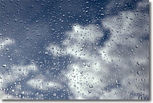
Drizzle is precipitation in the form of water droplets which are
smaller than raindrops.
Drizzle is characterized by fine, gently falling droplets and typically does not
impact human habitation in a negative way. The exception to this is freezing drizzle,
a condition where drizzle freezes immediately upon reaching earth's surface.
Freezing drizzle is still less dangerous than freezing rain, but can
potentially result in hazardous road conditions.
Next Topic: Evaporation
Weather Topic: What is Fog?
Home - Education - Cloud Types - Fog
 Next Topic: Fractus Clouds
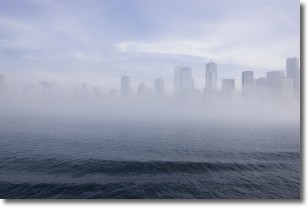
Fog is technically a type of stratus cloud, which lies along the
ground and obscures visibility.
It is usually created when humidity in the air condenses into tiny water droplets.
Because of this, some places are more prone to foggy weather, such as regions
close to a body of water.
Fog is similar to mist; both are the appearance of water droplets suspended in
the air, but fog is the term applied to the condition when visibility is less than 1 km.
Next Topic: Fractus Clouds
Current conditions powered by WeatherAPI.com


