Weather Alert in Kansas
Flood Warning issued August 27 at 8:17PM CDT until August 30 at 4:42AM CDT by NWS Wichita KS
AREAS AFFECTED: Butler, KS
DESCRIPTION: ...The Flood Warning continues for the following rivers in Kansas... Whitewater River at Towanda affecting Butler County. Whitewater River at Augusta affecting Butler and Cowley Counties. * WHAT...Moderate flooding is forecast. * WHERE...Whitewater River at Towanda. * WHEN...From Thursday afternoon to early Saturday morning. * IMPACTS...At 25.0 feet, Flooding over cropland becomes more widespread. County roads flood at Southwest 40th Street on low spots near the river about 2 miles downstream of gage and along Southwest 60th Street just west of Fulton Road near the river located 4 miles south of Towanda. Further downstream, 5 miles south of Towanda, expect flooding across Southwest 70th Street near the river. * ADDITIONAL DETAILS... - At 7:30 PM CDT Wednesday the stage was 1.9 feet. - Forecast...The river is expected to rise above flood stage early tomorrow afternoon to a crest of 26.2 feet early Friday morning. It will then fall below flood stage Friday afternoon. - Flood stage is 22.0 feet.
INSTRUCTION: Do not drive into flooded areas or go around barricades. Nearly two feet of water will carry most vehicles away. Turn around, don't drown. Additional information is available at www.weather.gov. The next statement will be issued Thursday morning at 830 AM CDT.
Want more detail? Get the Complete 7 Day and Night Detailed Forecast!
Current U.S. National Radar--Current
The Current National Weather Radar is shown below with a UTC Time (subtract 5 hours from UTC to get Eastern Time).

National Weather Forecast--Current
The Current National Weather Forecast and National Weather Map are shown below.

National Weather Forecast for Tomorrow
Tomorrow National Weather Forecast and Tomorrow National Weather Map are show below.

North America Water Vapor (Moisture)
This map shows recent moisture content over North America. Bright and colored areas show high moisture (ie, clouds); brown indicates very little moisture present; black indicates no moisture.

Weather Topic: What are Cumulonimbus Clouds?
Home - Education - Cloud Types - Cumulonimbus Clouds
 Next Topic: Cumulus Clouds
The final form taken by a growing cumulus cloud is the
cumulonimbus cloud, which is very tall and dense.
The tower of a cumulonimbus cloud can soar 23 km into the atmosphere, although
most commonly they stop growing at an altitude of 6 km.
Even small cumulonimbus clouds appear very large in comparison to other cloud types.
They can signal the approach of stormy weather, such as thunderstorms or blizzards.
Next Topic: Cumulus Clouds
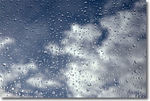
Weather Topic: What is Drizzle?
Home - Education - Precipitation - Drizzle
 Next Topic: Evaporation
Drizzle is precipitation in the form of water droplets which are
smaller than raindrops.
Drizzle is characterized by fine, gently falling droplets and typically does not
impact human habitation in a negative way. The exception to this is freezing drizzle,
a condition where drizzle freezes immediately upon reaching earth's surface.
Freezing drizzle is still less dangerous than freezing rain, but can
potentially result in hazardous road conditions.
Next Topic: Evaporation
Current conditions powered by WeatherAPI.com


