Weather Alert in West Virginia
Winter Storm Warning issued March 2 at 12:49AM EST until March 3 at 10:00AM EST by NWS Charleston WV
AREAS AFFECTED: Northwest Pocahontas; Southeast Randolph
DESCRIPTION: * WHAT...Heavy mixed precipitation expected. Total snow accumulations between 1 and 3 inches and ice accumulations up to three tenths of an inch. Locally higher amounts of ice accumulations could be possible. * WHERE...Northwest Pocahontas and Southeast Randolph Counties. * WHEN...From 7 AM this morning to 10 AM EST Tuesday. * IMPACTS...Power outages and tree damage are likely due to the ice. Travel could be nearly impossible this evening into Tuesday morning. The hazardous conditions could impact the morning and evening commutes as well as the Tuesday morning commute. * ADDITIONAL DETAILS...This event will start as all snow with a bulk of the snow accumulations falling this morning into the early afternoon. Freezing rain is then expected to start mixing in by the afternoon and will continue into the evening. This mix is expected to become mostly freezing rain tonight into Tuesday morning. This time period is where a bulk of the ice accretions will occur resulting in the impacts listed.
INSTRUCTION: If you must travel, keep an extra flashlight, food, and water in your vehicle in case of an emergency. The latest road conditions for the state you are calling from can be obtained by calling 5 1 1 or by accessing the online traffic and roadway portal for your state. Additional information can be found at https://www.weather.gov/rlx as well as on our X and Facebook pages.
Want more detail? Get the Complete 7 Day and Night Detailed Forecast!
Current U.S. National Radar--Current
The Current National Weather Radar is shown below with a UTC Time (subtract 5 hours from UTC to get Eastern Time).

National Weather Forecast--Current
The Current National Weather Forecast and National Weather Map are shown below.

National Weather Forecast for Tomorrow
Tomorrow National Weather Forecast and Tomorrow National Weather Map are show below.

North America Water Vapor (Moisture)
This map shows recent moisture content over North America. Bright and colored areas show high moisture (ie, clouds); brown indicates very little moisture present; black indicates no moisture.

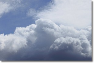
Weather Topic: What are Nimbostratus Clouds?
Home - Education - Cloud Types - Nimbostratus Clouds
 Next Topic: Precipitation
A nimbostratus cloud is similar to a stratus cloud in its formless,
smooth appearance. However, a nimbostratus cloud is darker than a stratus cloud,
because it is thicker.
Unlike a stratus cloud, a nimbostratus cloud typically brings with it the threat
of moderate to heavy precipitation. In some cases, the precipitation may evaporate
before reaching the ground, a phenomenon known as virga.
Next Topic: Precipitation
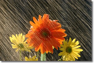
Weather Topic: What is Rain?
Home - Education - Precipitation - Rain
 Next Topic: Shelf Clouds
Precipitation in the form of water droplets is called rain.
Rain generally has a tendency to fall with less intensity over a greater period
of time, and when rainfall is more severe it is usually less sustained.
Rain is the most common form of precipitation and happens with greater frequency
depending on the season and regional influences. Cities have been shown to have
an observable effect on rainfall, due to an effect called the urban heat island.
Compared to upwind, monthly rainfall between twenty and forty miles downwind of
cities is 30% greater.
Next Topic: Shelf Clouds
Current conditions powered by WeatherAPI.com


