Weather Alert in New Mexico
Red Flag Warning issued February 24 at 12:44PM CST until February 25 at 8:00PM CST by NWS Midland/Odessa TX
AREAS AFFECTED: Chaves County Plains; Eddy Plains; Lea; Eastern Culberson County; Reeves County Plains
DESCRIPTION: ...RED FLAG WARNING REMAINS IN EFFECT UNTIL 9 PM CST/ 8 PM MST THIS EVENING FOR LOW RELATIVE HUMIDITY BELOW 15 PERCENT, 20 FOOT WINDS AROUND 20 MPH OR GREATER, AND HIGH FIRE DANGER IN THE SACRAMENTO, GUADALUPE, DELAWARE, AND DAVIS MOUNTAINS AND ADJACENT PLAINS OF NEW MEXICO AND CULBERSON AND REEVES COUNTIES... ...RED FLAG WARNING IN EFFECT FROM 11 AM CST/ 10 AM MST TO 8 PM CST/ 7 PM MST WEDNESDAY FOR WIND AND LOW RELATIVE HUMIDITY FOR LOW RELATIVE HUMIDITY BELOW 15 PERCENT, 20 FOOT WINDS ABOVE 20 MPH, AND HIGH FIRE DANGER IN THE SOUTHEAST NEW MEXICO PLAINS, WESTERN PERMIAN BASIN, AND UPPER TRANS PECOS... The National Weather Service in Midland/Odessa has issued a Red Flag Warning for wind and low relative humidity, which is in effect from 11 AM CST/ 10 AM MST to 8 PM CST/ 7 PM MST Wednesday. * WINDS...West/Northwest 20 to 30 mph with gusts up to 45 mph. * RELATIVE HUMIDITY...As low as 10 percent. * RFTI...3 to 6 or near critical to critical. * IMPACTS...Any fires that develop will likely spread rapidly. Outdoor burning is not recommended. * SEVERITY... FUELS...Dry WEATHER...Near Critical...2 (out of 5). FIRE ENVIRONMENT...5 (out of 10).
INSTRUCTION: A Red Flag Warning means that critical fire weather conditions are either occurring now or will shortly. A combination of strong winds, low relative humidity and warm temperatures will increase potential for fire growth.
Want more detail? Get the Complete 7 Day and Night Detailed Forecast!
Current U.S. National Radar--Current
The Current National Weather Radar is shown below with a UTC Time (subtract 5 hours from UTC to get Eastern Time).

National Weather Forecast--Current
The Current National Weather Forecast and National Weather Map are shown below.

National Weather Forecast for Tomorrow
Tomorrow National Weather Forecast and Tomorrow National Weather Map are show below.

North America Water Vapor (Moisture)
This map shows recent moisture content over North America. Bright and colored areas show high moisture (ie, clouds); brown indicates very little moisture present; black indicates no moisture.

Weather Topic: What is Evaporation?
Home - Education - Precipitation - Evaporation
 Next Topic: Fog
Evaporation is the process which returns water from the earth
back to the atmosphere, and is another crucial process in the water cycle.
Evaporation is the transformation of liquid into gas, and it happens because
molecules are excited by the application of energy and turn into vapor.
In order for water to evaporate it has to be on the surface of a body of water.
Next Topic: Fog
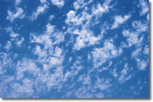
Weather Topic: What are Fractus Clouds?
Home - Education - Cloud Types - Fractus Clouds
 Next Topic: Freezing Rain
A fractus cloud (scud) is a fragmented, tattered cloud which has
likely been sheared off of another cloud. They are accessory clouds, meaning they
develop from parent clouds, and are named in a way which describes the original
cloud which contained them.
Fractus clouds which have originated from cumulus clouds are referred to as
cumulus fractus, while fractus clouds which have originated from stratus clouds
are referred to as stratus fractus. Under certain conditions a fractus cloud might
merge with another cloud, or develop into a cumulus cloud, but usually a
fractus cloud seen by itself will dissipate rapidly.
They are often observed on the leading and trailing edges of storm clouds,
and are a display of wind activity.
Next Topic: Freezing Rain
Current conditions powered by WeatherAPI.com


