Weather Alert in California
Red Flag Warning issued June 20 at 11:57AM PDT until June 22 at 9:00AM PDT by NWS Sacramento CA
AREAS AFFECTED: Northern Sacramento Valley to Southern Tehama County Line Below 1000 Ft; Central Sacramento Valley including Glenn/Colusa/Yuba/Northern Sutter/Butte County Below 1000 Ft; Southern Sacramento Valley In Yolo/Sacramento/Far Western Placer/Southern Sutter and Solano County Below 1000 Ft - Excludes the Delta; Eastern Delta; Northern San Joaquin Valley in San Joaquin and Stanislaus Counties Below 1000 ft - Excludes the Delta; Southeast Edge Shasta/Trinity NF and Western Portions of Tehama/Glenn RU; Eastern Mendocino NF
DESCRIPTION: The National Weather Service in Sacramento has issued a Red Flag Warning for gusty winds and low humidity, which is in effect from 11 AM Saturday to 9 AM PDT Sunday. The Fire Weather Watch is no longer in effect. * Winds...North winds 10 to 20 mph with gusts up of 30 to 40 mph. Strongest winds expected across the Sacramento Valley along and west of Interstate 5, the Delta, and the northern San Joaquin Valley. * Humidity...Minimum daytime humidity: 15 to 25 percent. Overnight recoveries in the mid 40s to mid 50s. * Highest Threat...Sacramento Valley along and west of the I- 5 corridor, adjacent Coastal Range, and the northern San Joaquin Valley. * Impacts...The combination of gusty winds and low humidity can cause fire to rapidly grow in size and intensity. Outdoor burning is not recommended.
INSTRUCTION: A Red Flag Warning means that critical fire weather conditions are either occurring now, or will shortly. A combination of strong winds, low relative humidity, and warm temperatures can contribute to extreme fire behavior.
Want more detail? Get the Complete 7 Day and Night Detailed Forecast!
Current U.S. National Radar--Current
The Current National Weather Radar is shown below with a UTC Time (subtract 5 hours from UTC to get Eastern Time).

National Weather Forecast--Current
The Current National Weather Forecast and National Weather Map are shown below.

National Weather Forecast for Tomorrow
Tomorrow National Weather Forecast and Tomorrow National Weather Map are show below.

North America Water Vapor (Moisture)
This map shows recent moisture content over North America. Bright and colored areas show high moisture (ie, clouds); brown indicates very little moisture present; black indicates no moisture.

Weather Topic: What is Drizzle?
Home - Education - Precipitation - Drizzle
 Next Topic: Evaporation
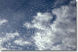
Drizzle is precipitation in the form of water droplets which are
smaller than raindrops.
Drizzle is characterized by fine, gently falling droplets and typically does not
impact human habitation in a negative way. The exception to this is freezing drizzle,
a condition where drizzle freezes immediately upon reaching earth's surface.
Freezing drizzle is still less dangerous than freezing rain, but can
potentially result in hazardous road conditions.
Next Topic: Evaporation
Weather Topic: What is Fog?
Home - Education - Cloud Types - Fog
 Next Topic: Fractus Clouds
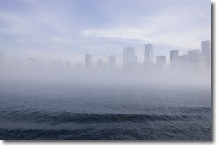
Fog is technically a type of stratus cloud, which lies along the
ground and obscures visibility.
It is usually created when humidity in the air condenses into tiny water droplets.
Because of this, some places are more prone to foggy weather, such as regions
close to a body of water.
Fog is similar to mist; both are the appearance of water droplets suspended in
the air, but fog is the term applied to the condition when visibility is less than 1 km.
Next Topic: Fractus Clouds
Current conditions powered by WeatherAPI.com


