Weather Alert in Alaska
Special Weather Statement issued February 24 at 11:03AM AKST by NWS Anchorage AK
AREAS AFFECTED: Central Aleutians
DESCRIPTION: A strong front will approach and then stall across the Central Aleutians, including the cities of Adak and Atka, on Wednesday afternoon with sustained winds of 40 to 45 mph, and increasing up to 55 mph through Thursday morning. Maximum wind gusts will occur Thursday morning with gusts as high as 60 to 65 mph. Accompanying the winds will be an axis of heavy precipitation, most likely in the form of heavy wet snow starting Wednesday afternoon, mixing with rain at times as temperatures remain steady in the mid 30s. Snowfall accumulations of 2 to 4 inches will be in store for Atka, while Adak may see lesser amounts due to potentially more rain mixing in. Winds will then slowly diminish through Friday morning, though gusts up to 40 to 45 mph will linger into the first half of the weekend. -AM
INSTRUCTION: N/A
Want more detail? Get the Complete 7 Day and Night Detailed Forecast!
Current U.S. National Radar--Current
The Current National Weather Radar is shown below with a UTC Time (subtract 5 hours from UTC to get Eastern Time).

National Weather Forecast--Current
The Current National Weather Forecast and National Weather Map are shown below.

National Weather Forecast for Tomorrow
Tomorrow National Weather Forecast and Tomorrow National Weather Map are show below.

North America Water Vapor (Moisture)
This map shows recent moisture content over North America. Bright and colored areas show high moisture (ie, clouds); brown indicates very little moisture present; black indicates no moisture.

Weather Topic: What are Wall Clouds?
Home - Education - Cloud Types - Wall Clouds
 Next Topic: Altocumulus Clouds
A wall cloud forms underneath the base of a cumulonimbus cloud,
and can be a hotbed for deadly tornadoes.
Wall clouds are formed by air flowing into the cumulonimbus clouds, which can
result in the wall cloud descending from the base of the cumulonimbus cloud, or
rising fractus clouds which join to the base of the storm cloud as the wall cloud
takes shape.
Wall clouds can be very large, and in the Northern Hemisphere they generally
form at the southern edge of cumulonimbus clouds.
Next Topic: Altocumulus Clouds
Weather Topic: What are Altostratus Clouds?
Home - Education - Cloud Types - Altostratus Clouds
 Next Topic: Cirrocumulus Clouds
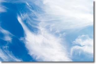
Altostratus clouds form at mid to high-level altitudes
(between 2 and 7 km) and are created by a warm, stable air mass which causes
water vapor
to condense as it rise through the atmosphere. Usually altostratus clouds are
featureless sheets characterized by a uniform color.
In some cases, wind punching through the cloud formation may give it a waved
appearance, called altostratus undulatus. Altostratus clouds
are commonly seen with other cloud formations accompanying them.
Next Topic: Cirrocumulus Clouds
Current conditions powered by WeatherAPI.com


