Weather Alert in Minnesota
Frost Advisory issued September 7 at 1:34PM CDT until September 8 at 8:00AM CDT by NWS Duluth MN
AREAS AFFECTED: Koochiching; North St. Louis; Central St. Louis; Carlton/South St. Louis; Douglas; Bayfield; Ashland; Iron; Sawyer; Price
DESCRIPTION: * WHAT...Temperatures as low as 33 will result in frost formation. * WHERE...In Minnesota, Koochiching, Carlton, St. Louis Counties. In Wisconsin, Price, Ashland, Bayfield, Douglas, Iron, and Sawyer Counties. This includes the Tribal Lands of the northwestern area of the Lac du Flambeau Band, the Red Cliff Band, the Lac Courte Oreilles Reservation, the Bad River Reservation, the Fond du Lac Band and the Bois Forte Band, Lake Vermilion and, Nett Lake areas. Other locations including Voyageurs National Park, the Apostle Islands National Lakeshore and Madeline Island. This also includes the Boundary Waters western area. * WHEN...From 1 AM to 8 AM CDT Monday. * IMPACTS...Frost could harm sensitive outdoor vegetation. Sensitive outdoor plants may be killed if left uncovered. * ADDITIONAL DETAILS...Areas within 10 miles of Lake Superior will be warmer and frost is less likely there. Frost will be less widespread compared to last night.
INSTRUCTION: Take steps now to protect tender plants from the cold.
Want more detail? Get the Complete 7 Day and Night Detailed Forecast!
Current U.S. National Radar--Current
The Current National Weather Radar is shown below with a UTC Time (subtract 5 hours from UTC to get Eastern Time).

National Weather Forecast--Current
The Current National Weather Forecast and National Weather Map are shown below.

National Weather Forecast for Tomorrow
Tomorrow National Weather Forecast and Tomorrow National Weather Map are show below.

North America Water Vapor (Moisture)
This map shows recent moisture content over North America. Bright and colored areas show high moisture (ie, clouds); brown indicates very little moisture present; black indicates no moisture.

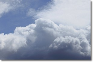
Weather Topic: What are Nimbostratus Clouds?
Home - Education - Cloud Types - Nimbostratus Clouds
 Next Topic: Precipitation
A nimbostratus cloud is similar to a stratus cloud in its formless,
smooth appearance. However, a nimbostratus cloud is darker than a stratus cloud,
because it is thicker.
Unlike a stratus cloud, a nimbostratus cloud typically brings with it the threat
of moderate to heavy precipitation. In some cases, the precipitation may evaporate
before reaching the ground, a phenomenon known as virga.
Next Topic: Precipitation
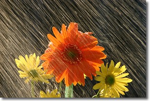
Weather Topic: What is Rain?
Home - Education - Precipitation - Rain
 Next Topic: Shelf Clouds
Precipitation in the form of water droplets is called rain.
Rain generally has a tendency to fall with less intensity over a greater period
of time, and when rainfall is more severe it is usually less sustained.
Rain is the most common form of precipitation and happens with greater frequency
depending on the season and regional influences. Cities have been shown to have
an observable effect on rainfall, due to an effect called the urban heat island.
Compared to upwind, monthly rainfall between twenty and forty miles downwind of
cities is 30% greater.
Next Topic: Shelf Clouds
Current conditions powered by WeatherAPI.com


