Weather Alert in North Carolina
Special Weather Statement issued February 5 at 8:16PM EST by NWS Newport/Morehead City NC
AREAS AFFECTED: Beaufort; Mainland Hyde; Jones; Pamlico; Northern Craven; Southern Craven; West Carteret; East Carteret; Inland Onslow; Coastal Onslow
DESCRIPTION: The mix of rain, snow, sleet, and ice pellets, has further dampened the ground near the Crystal Coast this evening resulting in fairly widespread wet spots across portions of Onslow to Carteret County and areas north to Beaufort and mainland Hyde Counties. With temps quickly forecast to fall below freezing tonight, don't think these more widespread wet spots will dry in time, so black ice has become a concern. This threat will last until about 9AM before temps quickly warm above freezing and the black ice threat greatly lowers. Biggest areas of concern will be across bridges, overpasses, and any elevated roadways. Thin sheets of ice, called black ice, may be difficult to see, especially during the pre-dawn hours. They may appear to be wet spots on the road. Motorists will have a difficult time determining which spots are just wet and which are icy. Motorists are advised to use extra caution. Allow ample distance between yourself and other vehicles, to avoid the risk of a collision if slippery conditions are encountered. Allow a little extra time to reach your destination safely.
INSTRUCTION: N/A
Want more detail? Get the Complete 7 Day and Night Detailed Forecast!
Current U.S. National Radar--Current
The Current National Weather Radar is shown below with a UTC Time (subtract 5 hours from UTC to get Eastern Time).

National Weather Forecast--Current
The Current National Weather Forecast and National Weather Map are shown below.

National Weather Forecast for Tomorrow
Tomorrow National Weather Forecast and Tomorrow National Weather Map are show below.

North America Water Vapor (Moisture)
This map shows recent moisture content over North America. Bright and colored areas show high moisture (ie, clouds); brown indicates very little moisture present; black indicates no moisture.

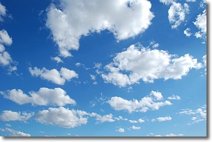
Weather Topic: What are Cumulonimbus Clouds?
Home - Education - Cloud Types - Cumulonimbus Clouds
 Next Topic: Cumulus Clouds
The final form taken by a growing cumulus cloud is the
cumulonimbus cloud, which is very tall and dense.
The tower of a cumulonimbus cloud can soar 23 km into the atmosphere, although
most commonly they stop growing at an altitude of 6 km.
Even small cumulonimbus clouds appear very large in comparison to other cloud types.
They can signal the approach of stormy weather, such as thunderstorms or blizzards.
Next Topic: Cumulus Clouds
Weather Topic: What is Drizzle?
Home - Education - Precipitation - Drizzle
 Next Topic: Evaporation
Drizzle is precipitation in the form of water droplets which are
smaller than raindrops.
Drizzle is characterized by fine, gently falling droplets and typically does not
impact human habitation in a negative way. The exception to this is freezing drizzle,
a condition where drizzle freezes immediately upon reaching earth's surface.
Freezing drizzle is still less dangerous than freezing rain, but can
potentially result in hazardous road conditions.
Next Topic: Evaporation
Current conditions powered by WeatherAPI.com


