Weather Alert in Massachusetts
Coastal Flood Statement issued August 21 at 1:03PM EDT until August 23 at 2:00AM EDT by NWS Boston/Norton MA
AREAS AFFECTED: Eastern Essex; Eastern Plymouth
DESCRIPTION: * WHAT...Large breaking waves of 10 to 15 feet on ocean beaches. Some splashover on vulnerable coastal roads around high tide tonight through Friday night. * WHERE...Eastern Massachusetts coast. * WHEN...For the High Surf Advisory, until 8 PM EDT Saturday. * IMPACTS...Some water on low lying roads and property around high tide. Dangerous swimming and surfing conditions and significant beach erosion.
INSTRUCTION: Many ocean beaches are closed. Stay out out of the water due to dangerous surf conditions. Only view surf at a safe distance, not from near the shore, or from jetties or piers. Avoid any flooded roads during high tide.
Want more detail? Get the Complete 7 Day and Night Detailed Forecast!
Current U.S. National Radar--Current
The Current National Weather Radar is shown below with a UTC Time (subtract 5 hours from UTC to get Eastern Time).

National Weather Forecast--Current
The Current National Weather Forecast and National Weather Map are shown below.

National Weather Forecast for Tomorrow
Tomorrow National Weather Forecast and Tomorrow National Weather Map are show below.

North America Water Vapor (Moisture)
This map shows recent moisture content over North America. Bright and colored areas show high moisture (ie, clouds); brown indicates very little moisture present; black indicates no moisture.

Weather Topic: What are Altostratus Clouds?
Home - Education - Cloud Types - Altostratus Clouds
 Next Topic: Cirrocumulus Clouds
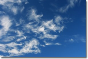
Altostratus clouds form at mid to high-level altitudes
(between 2 and 7 km) and are created by a warm, stable air mass which causes
water vapor
to condense as it rise through the atmosphere. Usually altostratus clouds are
featureless sheets characterized by a uniform color.
In some cases, wind punching through the cloud formation may give it a waved
appearance, called altostratus undulatus. Altostratus clouds
are commonly seen with other cloud formations accompanying them.
Next Topic: Cirrocumulus Clouds
Weather Topic: What are Cirrostratus Clouds?
Home - Education - Cloud Types - Cirrostratus Clouds
 Next Topic: Cirrus Clouds
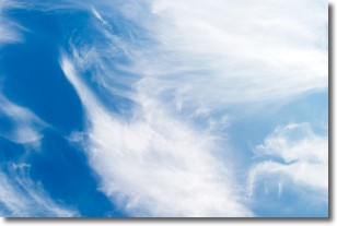
Cirrostratus clouds are high, thin clouds that form above
20,000 feet and are made mostly of ice crystals. They sometimes look like giant
feathers, horse tails, or curls of hair in the sky.
These clouds are pushed by the jet stream and can move at high speeds reaching
100 mph.
What do they indicate?
They indicate that a precipitation is likely within 24 hours.
Next Topic: Cirrus Clouds
Current conditions powered by WeatherAPI.com


