Weather Alert in South Carolina
Flood Warning issued August 14 at 10:17PM EDT by NWS Wilmington NC
AREAS AFFECTED: Horry, SC
DESCRIPTION: ...The Flood Warning is extended for the following rivers in North Carolina... Cape Fear River At William O Huske Lock And Dam 3 affecting Bladen and Cumberland Counties. ...The Flood Warning continues for the following rivers in South Carolina...North Carolina... Waccamaw River At Conway affecting Horry County. Waccamaw River near Longs affecting Columbus, Brunswick and Horry Counties. * WHAT...Minor flooding is occurring and minor flooding is forecast. * WHERE...Waccamaw River at Conway. * WHEN...Until further notice. * IMPACTS...At 12.0 feet, Flooding will worsen in Lees Landing, Riverfront South, Pitch Landing, and Savannah Bluff. Flooding will also worsen along Waccamaw CIR, Riverside DR, and in low areas along Gray Oak DR. Flood waters will begin to affect Black Moss DR and Cypress Flat. Depot RD, New RD, and Jackson Bluff RD may begin to flood. The lowest homes on Riverside DR north of Conway may be affected. Witch Golf Course may begin to flood. Swamps will be heavily flooded. * ADDITIONAL DETAILS... - At 9:15 PM EDT Thursday the stage was 11.5 feet. - Forecast...The river is expected to rise to 11.9 feet Monday evening. Additional rises are possible thereafter. - Flood stage is 11.0 feet. - weather.gov/safety/flood
INSTRUCTION: Motorists should not attempt to drive around barricades or drive cars through flooded areas. Stay tuned to further developments by listening to your local radio, television, or NOAA Weather Radio for further information. Caution is urged when walking near riverbanks. Additional information is available at water.noaa.gov/wfo/ilm . The next statement will be issued by Friday afternoon.
Want more detail? Get the Complete 7 Day and Night Detailed Forecast!
Current U.S. National Radar--Current
The Current National Weather Radar is shown below with a UTC Time (subtract 5 hours from UTC to get Eastern Time).

National Weather Forecast--Current
The Current National Weather Forecast and National Weather Map are shown below.

National Weather Forecast for Tomorrow
Tomorrow National Weather Forecast and Tomorrow National Weather Map are show below.

North America Water Vapor (Moisture)
This map shows recent moisture content over North America. Bright and colored areas show high moisture (ie, clouds); brown indicates very little moisture present; black indicates no moisture.

Weather Topic: What is Sleet?
Home - Education - Precipitation - Sleet
 Next Topic: Snow
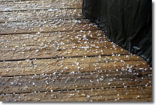
Sleet is a form of precipitation in which small ice pellets are the primary
components. These ice pellets are smaller and more translucent than hailstones,
and harder than graupel. Sleet is caused by specific atmospheric conditions and
therefore typically doesn't last for extended periods of time.
The condition which leads to sleet formation requires a warmer body of air to be
wedged in between two sub-freezing bodies of air. When snow falls through a warmer
layer of air it melts, and as it falls through the next sub-freezing body of air
it freezes again, forming ice pellets known as sleet. In some cases, water
droplets don't have time to freeze before reaching the surface and the result is
freezing rain.
Next Topic: Snow
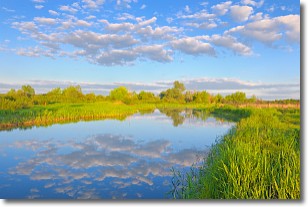
Weather Topic: What are Stratocumulus Clouds?
Home - Education - Cloud Types - Stratocumulus Clouds
 Next Topic: Stratus Clouds
Stratocumulus clouds are similar to altocumulus clouds in their
fluffy appearance, but have a slightly darker shade due to their additional mass.
A good way to distinguish the two cloud types is to hold your hand out and measure
the size of an individual cloud; if it is the size of your thumb it is generally
an altocumulus cloud, if it is the size of your hand it is generally a
stratocumulus cloud.
It is uncommon for stratocumulus clouds to produce precipitation, but if they do
it is usually a light rain or snow.
Next Topic: Stratus Clouds
Current conditions powered by WeatherAPI.com


