Weather Alert in Montana
Air Quality Alert issued September 2 at 9:03AM MDT by NWS Great Falls MT
AREAS AFFECTED: Daniels, MT; Dawson, MT; McCone, MT; Richland, MT; Roosevelt, MT; Sheridan, MT; Valley, MT
DESCRIPTION: AQAMT The Montana Department of Environmental Quality has issued an air quality alert for Daniels, Dawson, McCone, Richland, Roosevelt, Sheridan, Valley counties in effect until 9AM on 09/03/2025 An Air Quality Alert means that particulates have been trending upwards and that an exceedence of the 24 hour National Ambient Air Quality Standard (NAAQS) has occurred or may occur in the near future. Elevated particulate levels from wildfire smoke As of 8AM on 09/02/2025, particulate levels in Glendive are Unhealthy for Sensitive Groups. As of 8AM on 09/02/2025, particulate levels in Billings, Butte, Columbia Falls, Cut Bank, Frenchtown, Great Falls, Lewistown, Missoula, Seeley Lake, Sidney and Thompson Falls are Moderate. When air quality is Unhealthy for Sensitive Groups... State and local health officials recommend that people with respiratory or heart disease, the elderly and children should limit prolonged exertion. When air quality is Moderate... State and local health officials recommend that unusually sensitive people should consider reducing prolonged or heavy exertion. For more information visit the Montana Department of Environmental Quality at http://todaysair.mtdeq.us
INSTRUCTION: N/A
Want more detail? Get the Complete 7 Day and Night Detailed Forecast!
Current U.S. National Radar--Current
The Current National Weather Radar is shown below with a UTC Time (subtract 5 hours from UTC to get Eastern Time).

National Weather Forecast--Current
The Current National Weather Forecast and National Weather Map are shown below.

National Weather Forecast for Tomorrow
Tomorrow National Weather Forecast and Tomorrow National Weather Map are show below.

North America Water Vapor (Moisture)
This map shows recent moisture content over North America. Bright and colored areas show high moisture (ie, clouds); brown indicates very little moisture present; black indicates no moisture.

Weather Topic: What is Snow?
Home - Education - Precipitation - Snow
 Next Topic: Stratocumulus Clouds
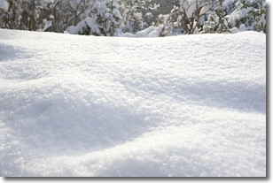
Snow is precipitation taking the form of ice crystals. Each ice crystal, or snowflake,
has unique characteristics, but all of them grow in a hexagonal structure.
Snowfall can last for sustained periods of time and result in significant buildup
of snow on the ground.
On the earth's surface, snow starts out light and powdery, but as it begins to melt
it tends to become more granular, producing small bits of ice which have the consistency of
sand. After several cycles of melting and freezing, snow can become very dense
and ice-like, commonly known as snow pack.
Next Topic: Stratocumulus Clouds
Weather Topic: What are Stratus Clouds?
Home - Education - Cloud Types - Stratus Clouds
 Next Topic: Wall Clouds
Stratus clouds are similar to altostratus clouds, but form at a
lower altitude and are identified by their fog-like appearance, lacking the
distinguishing features of most clouds.
Stratus clouds are wider than most clouds, and their base has a smooth, uniform
look which is lighter in color than a nimbostratus cloud.
The presence of a stratus cloud indicates the possibility of minor precipitation,
such as drizzle, but heavier precipitation does not typically arrive in the form
of a stratus cloud.
Next Topic: Wall Clouds
Current conditions powered by WeatherAPI.com


