Weather Alert in Indiana
Flood Warning issued March 4 at 12:17PM EST until March 12 at 9:06PM EDT by NWS Indianapolis IN
AREAS AFFECTED: Daviess, IN; Gibson, IN; Knox, IN; Pike, IN
DESCRIPTION: ...The National Weather Service in Indianapolis IN has issued a Flood Warning for the following rivers in Indiana... White River below Eagle Valley Power Plant. White River near Centerton. White River at Edwardsport. White River at Petersburg. ...Forecast flooding changed from Minor to Moderate severity and increased in duration for the following rivers in Indiana... White River at Elliston. White River at Newberry. .Rainfall amounts between two and four inches over parts of central and southern Indiana have led to rises and some flooding on area rivers. Additional rainfall of one to three inches this evening into Thursday morning, with locally higher amounts possible, will bring widespread minor river flooding with pockets of moderate flooding to much of the East Fork White and lower White River basins. * WHAT...Moderate flooding is forecast. * WHERE...White River at Edwardsport. * WHEN...From Thursday afternoon to Thursday, March 12. * IMPACTS...At 23.0 feet, State Road 58 near Elnora floods. Water reaches Critical stage for McGinnis levee. Some residents leave river cabins if flooding will be long. * ADDITIONAL DETAILS... - At 7:00 AM EST Wednesday /6:00 AM CST Wednesday/ the stage was 6.7 feet. - Forecast...The river is expected to rise above flood stage early tomorrow afternoon to a crest of 23.0 feet Sunday morning. It will then fall below flood stage Thursday, March 12. - Flood stage is 15.0 feet. - http://www.weather.gov/safety/flood
INSTRUCTION: Motorists should not attempt to drive around barricades or drive cars through flooded areas. Additional information is available at www.weather.gov/ind. The next statement should be issued this evening by around 1130 PM EST /1030 PM CST/.
Want more detail? Get the Complete 7 Day and Night Detailed Forecast!
Current U.S. National Radar--Current
The Current National Weather Radar is shown below with a UTC Time (subtract 5 hours from UTC to get Eastern Time).

National Weather Forecast--Current
The Current National Weather Forecast and National Weather Map are shown below.

National Weather Forecast for Tomorrow
Tomorrow National Weather Forecast and Tomorrow National Weather Map are show below.

North America Water Vapor (Moisture)
This map shows recent moisture content over North America. Bright and colored areas show high moisture (ie, clouds); brown indicates very little moisture present; black indicates no moisture.

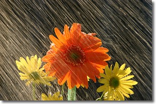
Weather Topic: What is Rain?
Home - Education - Precipitation - Rain
 Next Topic: Shelf Clouds
Precipitation in the form of water droplets is called rain.
Rain generally has a tendency to fall with less intensity over a greater period
of time, and when rainfall is more severe it is usually less sustained.
Rain is the most common form of precipitation and happens with greater frequency
depending on the season and regional influences. Cities have been shown to have
an observable effect on rainfall, due to an effect called the urban heat island.
Compared to upwind, monthly rainfall between twenty and forty miles downwind of
cities is 30% greater.
Next Topic: Shelf Clouds
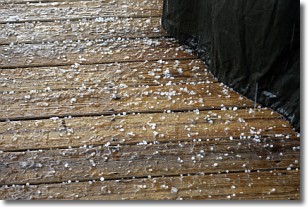
Weather Topic: What is Sleet?
Home - Education - Precipitation - Sleet
 Next Topic: Snow
Sleet is a form of precipitation in which small ice pellets are the primary
components. These ice pellets are smaller and more translucent than hailstones,
and harder than graupel. Sleet is caused by specific atmospheric conditions and
therefore typically doesn't last for extended periods of time.
The condition which leads to sleet formation requires a warmer body of air to be
wedged in between two sub-freezing bodies of air. When snow falls through a warmer
layer of air it melts, and as it falls through the next sub-freezing body of air
it freezes again, forming ice pellets known as sleet. In some cases, water
droplets don't have time to freeze before reaching the surface and the result is
freezing rain.
Next Topic: Snow
Current conditions powered by WeatherAPI.com


