Weather Alert in Michigan
Special Weather Statement issued February 5 at 7:41PM EST by NWS Gaylord MI
AREAS AFFECTED: Emmet; Cheboygan; Presque Isle; Leelanau; Antrim; Otsego; Montmorency; Alpena; Benzie; Grand Traverse; Kalkaska; Crawford; Oscoda; Alcona; Manistee; Wexford; Missaukee; Roscommon; Ogemaw; Iosco; Gladwin; Arenac; Western Chippewa; Central Chippewa; Southeast Chippewa; Western Mackinac; Eastern Mackinac; Mackinac Island/Bois Blanc Island; Beaver Island and surrounding islands; Charlevoix
DESCRIPTION: Steadiest snowfall has shifted east of I-75 across northern lower and eastern upper Michigan. In the wake of the snowfall, areas of freezing drizzle have begun to mix in west of I-75 in northern lower Michigan and portions of eastern upper Michigan. This will continue eastward toward the Lake Huron shores of northern lower Michigan this evening, with freezing drizzle potential carrying into the overnight hours until the next round of snow builds into the region from the northwest between roughly 2:00am and 6:00am. As such, a glaze of ice is possible on all untreated surfaces through the evening into tonight. Be cognizant of weather conditions if you must travel this evening into tonight, as slippery surfaces may materialize on area roads, particularly on bridges and overpasses. Remember to increase your following distance in wintry weather, and to take it slow in ice and snow!
INSTRUCTION: N/A
Want more detail? Get the Complete 7 Day and Night Detailed Forecast!
Current U.S. National Radar--Current
The Current National Weather Radar is shown below with a UTC Time (subtract 5 hours from UTC to get Eastern Time).

National Weather Forecast--Current
The Current National Weather Forecast and National Weather Map are shown below.

National Weather Forecast for Tomorrow
Tomorrow National Weather Forecast and Tomorrow National Weather Map are show below.

North America Water Vapor (Moisture)
This map shows recent moisture content over North America. Bright and colored areas show high moisture (ie, clouds); brown indicates very little moisture present; black indicates no moisture.

Weather Topic: What is Evaporation?
Home - Education - Precipitation - Evaporation
 Next Topic: Fog
Evaporation is the process which returns water from the earth
back to the atmosphere, and is another crucial process in the water cycle.
Evaporation is the transformation of liquid into gas, and it happens because
molecules are excited by the application of energy and turn into vapor.
In order for water to evaporate it has to be on the surface of a body of water.
Next Topic: Fog
Weather Topic: What are Fractus Clouds?
Home - Education - Cloud Types - Fractus Clouds
 Next Topic: Freezing Rain
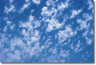
A fractus cloud (scud) is a fragmented, tattered cloud which has
likely been sheared off of another cloud. They are accessory clouds, meaning they
develop from parent clouds, and are named in a way which describes the original
cloud which contained them.
Fractus clouds which have originated from cumulus clouds are referred to as
cumulus fractus, while fractus clouds which have originated from stratus clouds
are referred to as stratus fractus. Under certain conditions a fractus cloud might
merge with another cloud, or develop into a cumulus cloud, but usually a
fractus cloud seen by itself will dissipate rapidly.
They are often observed on the leading and trailing edges of storm clouds,
and are a display of wind activity.
Next Topic: Freezing Rain
Current conditions powered by WeatherAPI.com


