Weather Alert in New York
Special Weather Statement issued September 4 at 2:44AM EDT by NWS Burlington VT
AREAS AFFECTED: Northern Franklin; Eastern Clinton; Western Clinton; Eastern Essex; Grand Isle; Western Franklin; Orleans; Essex; Western Chittenden; Lamoille; Caledonia; Washington; Western Addison; Orange; Western Rutland; Eastern Franklin; Eastern Chittenden; Eastern Addison; Eastern Rutland; Western Windsor; Eastern Windsor
DESCRIPTION: Fine fuels remain very dry across the area according to the Vermont Department of Forests, Parks and Recreation and the New York State Department of Environmental Conservation. Portions of the region are also in moderate drought. Southerly winds will quickly increase to 10 to 20 MPH today, with gusts up to 25 MPH. Localized gusts up to 35 MPH will occur in the Champlain Valley and far northern Adirondacks. These winds, combined with low relative humidity values between 25% and 35%, will create near critical fire weather conditions. Winds will be strongest between noon and 8 PM, coinciding with the timing of the minimum relative humidity values. If any fires were to start the weather and fuel conditions could cause them to quickly get out of control and be difficult to contain. Fire weather conditions will quickly improve as a wetting rain arrives in the late afternoon and evening. For more information about the current fire danger rating, any burn restrictions, and wildfire prevention and education, please visit your state forestry or environmental protection website.
INSTRUCTION: N/A
Want more detail? Get the Complete 7 Day and Night Detailed Forecast!
Current U.S. National Radar--Current
The Current National Weather Radar is shown below with a UTC Time (subtract 5 hours from UTC to get Eastern Time).

National Weather Forecast--Current
The Current National Weather Forecast and National Weather Map are shown below.

National Weather Forecast for Tomorrow
Tomorrow National Weather Forecast and Tomorrow National Weather Map are show below.

North America Water Vapor (Moisture)
This map shows recent moisture content over North America. Bright and colored areas show high moisture (ie, clouds); brown indicates very little moisture present; black indicates no moisture.

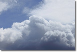
Weather Topic: What are Nimbostratus Clouds?
Home - Education - Cloud Types - Nimbostratus Clouds
 Next Topic: Precipitation
A nimbostratus cloud is similar to a stratus cloud in its formless,
smooth appearance. However, a nimbostratus cloud is darker than a stratus cloud,
because it is thicker.
Unlike a stratus cloud, a nimbostratus cloud typically brings with it the threat
of moderate to heavy precipitation. In some cases, the precipitation may evaporate
before reaching the ground, a phenomenon known as virga.
Next Topic: Precipitation
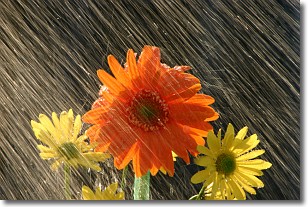
Weather Topic: What is Rain?
Home - Education - Precipitation - Rain
 Next Topic: Shelf Clouds
Precipitation in the form of water droplets is called rain.
Rain generally has a tendency to fall with less intensity over a greater period
of time, and when rainfall is more severe it is usually less sustained.
Rain is the most common form of precipitation and happens with greater frequency
depending on the season and regional influences. Cities have been shown to have
an observable effect on rainfall, due to an effect called the urban heat island.
Compared to upwind, monthly rainfall between twenty and forty miles downwind of
cities is 30% greater.
Next Topic: Shelf Clouds
Current conditions powered by WeatherAPI.com


