Weather Alert in Montana
High Wind Watch issued March 6 at 1:19PM MST until March 8 at 11:00PM MST by NWS Great Falls MT
AREAS AFFECTED: Eastern Toole and Liberty; Hill County; Northern Blaine County; Eastern Pondera and Eastern Teton; Upper Blackfoot and MacDonald Pass; Gates of the Mountains; Little Belt and Highwood Mountains; Snowy and Judith Mountains; Helena Valley; Big Belt, Bridger and Castle Mountains; Meagher County Valleys; Elkhorn and Boulder Mountains; Canyon Ferry Area; Missouri Headwaters; Gallatin Valley
DESCRIPTION: * WHAT...West winds 30 to 45 mph with gusts up to 70 mph possible. * WHERE...Portions of central, north central, and southwest Montana. * WHEN...From late Saturday night through Sunday evening. * IMPACTS...High winds may move loose debris, damage property and cause power outages. Travel could be difficult, especially for high profile vehicles. Damaging winds may blow down trees and power lines. Blowing dust could significantly reduce visibility at times.
INSTRUCTION: Monitor the latest forecasts and warnings for updates. Remember, a High Wind Watch means that there is at least a 50% chance of 40 mph sustained winds or 58 mph wind gusts occurring during the watch period.
Want more detail? Get the Complete 7 Day and Night Detailed Forecast!
Current U.S. National Radar--Current
The Current National Weather Radar is shown below with a UTC Time (subtract 5 hours from UTC to get Eastern Time).

National Weather Forecast--Current
The Current National Weather Forecast and National Weather Map are shown below.

National Weather Forecast for Tomorrow
Tomorrow National Weather Forecast and Tomorrow National Weather Map are show below.

North America Water Vapor (Moisture)
This map shows recent moisture content over North America. Bright and colored areas show high moisture (ie, clouds); brown indicates very little moisture present; black indicates no moisture.

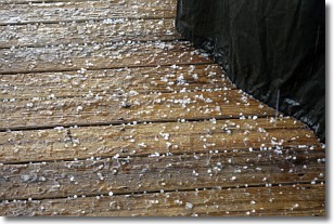
Weather Topic: What is Sleet?
Home - Education - Precipitation - Sleet
 Next Topic: Snow
Sleet is a form of precipitation in which small ice pellets are the primary
components. These ice pellets are smaller and more translucent than hailstones,
and harder than graupel. Sleet is caused by specific atmospheric conditions and
therefore typically doesn't last for extended periods of time.
The condition which leads to sleet formation requires a warmer body of air to be
wedged in between two sub-freezing bodies of air. When snow falls through a warmer
layer of air it melts, and as it falls through the next sub-freezing body of air
it freezes again, forming ice pellets known as sleet. In some cases, water
droplets don't have time to freeze before reaching the surface and the result is
freezing rain.
Next Topic: Snow
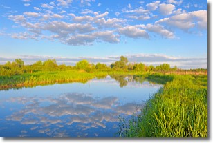
Weather Topic: What are Stratocumulus Clouds?
Home - Education - Cloud Types - Stratocumulus Clouds
 Next Topic: Stratus Clouds
Stratocumulus clouds are similar to altocumulus clouds in their
fluffy appearance, but have a slightly darker shade due to their additional mass.
A good way to distinguish the two cloud types is to hold your hand out and measure
the size of an individual cloud; if it is the size of your thumb it is generally
an altocumulus cloud, if it is the size of your hand it is generally a
stratocumulus cloud.
It is uncommon for stratocumulus clouds to produce precipitation, but if they do
it is usually a light rain or snow.
Next Topic: Stratus Clouds
Current conditions powered by WeatherAPI.com


