Weather Alert in North Carolina
Coastal Flood Warning issued August 21 at 11:10PM EDT until August 23 at 12:00AM EDT by NWS Newport/Morehead City NC
AREAS AFFECTED: Northern Outer Banks; Hatteras Island
DESCRIPTION: * WHAT...For the Coastal Flood Warning, up to two to three feet of inundation above ground level in low-lying areas near shorelines and tidal waterways. For the High Surf Advisory, large breaking waves of 5 to 10 feet in the surf zone. For the Beach Hazards Statement, dangerous rip currents and large breaking waves expected in the surf zone. * WHERE...Northern Outer Banks and Hatteras Island. * WHEN...For the Coastal Flood Warning, until midnight EDT Friday night. For the Beach Hazards Statement, from 7 AM EDT Friday through Friday evening. * IMPACTS...Up to 2 to 3 feet of inundation above ground level (with locally higher inundation) is possible in some areas near shorelines and tidal waterways resulting in an elevated threat of property damage. Flooding will extend inland from the waterfront threatening some homes and businesses. Road closures and flooding of vehicles will be possible. Significant impacts from ocean overwash are likely to continue around high tide both Friday morning and Friday evening due to continued elevated water levels, high astronomical tides, and persisting powerful swell and wave run up. Dangerous swimming and surfing conditions and localized beach erosion. Rip currents can sweep even the best swimmers away from shore into deeper water. Dangerous shore break can throw a swimmer or surfer head first into the bottom causing neck and back injuries. * ADDITIONAL DETAILS...The most likely time for strong rip currents to occur is a couple hours either side of low tide, which will occur around 1:30 PM Friday.
INSTRUCTION: Take the necessary actions to protect flood-prone property. If travel is required, do not drive around barricades or through water of unknown depth. Inexperienced swimmers should remain out of the water due to dangerous surf conditions. Life-threatening rip currents. If caught in a rip current, remain calm. Swim in a direction following the shoreline. If tired, float or tread water until out of the rip current. If unable to escape, face the shore and call or wave for help. Shore break occurs when waves break directly on the beach. It is extremely important to protect your head and neck whenever you are in breaking waves by keeping your hands in front of you at all times.
Want more detail? Get the Complete 7 Day and Night Detailed Forecast!
Current U.S. National Radar--Current
The Current National Weather Radar is shown below with a UTC Time (subtract 5 hours from UTC to get Eastern Time).

National Weather Forecast--Current
The Current National Weather Forecast and National Weather Map are shown below.

National Weather Forecast for Tomorrow
Tomorrow National Weather Forecast and Tomorrow National Weather Map are show below.

North America Water Vapor (Moisture)
This map shows recent moisture content over North America. Bright and colored areas show high moisture (ie, clouds); brown indicates very little moisture present; black indicates no moisture.

Weather Topic: What is Snow?
Home - Education - Precipitation - Snow
 Next Topic: Stratocumulus Clouds
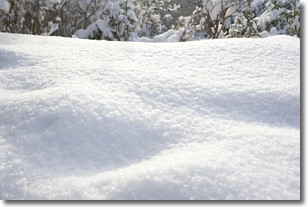
Snow is precipitation taking the form of ice crystals. Each ice crystal, or snowflake,
has unique characteristics, but all of them grow in a hexagonal structure.
Snowfall can last for sustained periods of time and result in significant buildup
of snow on the ground.
On the earth's surface, snow starts out light and powdery, but as it begins to melt
it tends to become more granular, producing small bits of ice which have the consistency of
sand. After several cycles of melting and freezing, snow can become very dense
and ice-like, commonly known as snow pack.
Next Topic: Stratocumulus Clouds
Weather Topic: What are Stratus Clouds?
Home - Education - Cloud Types - Stratus Clouds
 Next Topic: Wall Clouds
Stratus clouds are similar to altostratus clouds, but form at a
lower altitude and are identified by their fog-like appearance, lacking the
distinguishing features of most clouds.
Stratus clouds are wider than most clouds, and their base has a smooth, uniform
look which is lighter in color than a nimbostratus cloud.
The presence of a stratus cloud indicates the possibility of minor precipitation,
such as drizzle, but heavier precipitation does not typically arrive in the form
of a stratus cloud.
Next Topic: Wall Clouds
Current conditions powered by WeatherAPI.com


