Weather Alert in Maine
Special Weather Statement issued February 24 at 6:45PM EST by NWS Gray ME
AREAS AFFECTED: Southern Oxford; Interior York; Central Interior Cumberland; Androscoggin; Coastal York; Coastal Cumberland; Interior Cumberland Highlands; Northern Grafton; Northern Carroll; Southern Grafton; Southern Carroll; Sullivan; Merrimack; Belknap; Strafford; Cheshire; Eastern Hillsborough; Interior Rockingham; Coastal Rockingham; Western And Central Hillsborough
DESCRIPTION: A brief period of light to moderate snow will overspread the region from west to east between 7 and 9 am Wednesday morning. The snow will be short lived and exit to the east by early afternoon in most locations with between 1-3" of accumulation, but localized 4" amounts are possible. Motorists should be prepared for a period of snow covered roads and reduced visibility for the morning commute. Temperatures will rise above freezing later in the day in most locations, allowing for improving travel conditions.
INSTRUCTION: N/A
Want more detail? Get the Complete 7 Day and Night Detailed Forecast!
Current U.S. National Radar--Current
The Current National Weather Radar is shown below with a UTC Time (subtract 5 hours from UTC to get Eastern Time).

National Weather Forecast--Current
The Current National Weather Forecast and National Weather Map are shown below.

National Weather Forecast for Tomorrow
Tomorrow National Weather Forecast and Tomorrow National Weather Map are show below.

North America Water Vapor (Moisture)
This map shows recent moisture content over North America. Bright and colored areas show high moisture (ie, clouds); brown indicates very little moisture present; black indicates no moisture.

Weather Topic: What is Snow?
Home - Education - Precipitation - Snow
 Next Topic: Stratocumulus Clouds
Snow is precipitation taking the form of ice crystals. Each ice crystal, or snowflake,
has unique characteristics, but all of them grow in a hexagonal structure.
Snowfall can last for sustained periods of time and result in significant buildup
of snow on the ground.
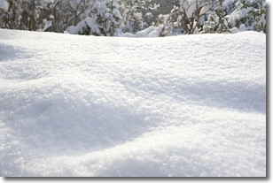
On the earth's surface, snow starts out light and powdery, but as it begins to melt
it tends to become more granular, producing small bits of ice which have the consistency of
sand. After several cycles of melting and freezing, snow can become very dense
and ice-like, commonly known as snow pack.
Next Topic: Stratocumulus Clouds
Weather Topic: What are Stratus Clouds?
Home - Education - Cloud Types - Stratus Clouds
 Next Topic: Wall Clouds
Stratus clouds are similar to altostratus clouds, but form at a
lower altitude and are identified by their fog-like appearance, lacking the
distinguishing features of most clouds.
Stratus clouds are wider than most clouds, and their base has a smooth, uniform
look which is lighter in color than a nimbostratus cloud.
The presence of a stratus cloud indicates the possibility of minor precipitation,
such as drizzle, but heavier precipitation does not typically arrive in the form
of a stratus cloud.
Next Topic: Wall Clouds
Current conditions powered by WeatherAPI.com


