Weather Alert in Maryland
Dense Fog Advisory issued March 7 at 7:08AM EST until March 7 at 10:00AM EST by NWS Wakefield VA
AREAS AFFECTED: Wicomico; Somerset; Inland Worcester; Maryland Beaches; Northampton; Hertford; Gates; Pasquotank; Camden; Western Currituck; Bertie; Chowan; Perquimans; Eastern Currituck; Prince Edward; Cumberland; Mecklenburg; Lunenburg; Nottoway; Amelia; Powhatan; Lancaster; Brunswick; Dinwiddie; Prince George; Charles City; New Kent; Gloucester; Middlesex; Mathews; Greensville; Sussex; Surry; James City; Southampton; Isle of Wight; Norfolk/Portsmouth; Suffolk; Chesapeake; Virginia Beach; Accomack; Northampton; Western Chesterfield; Eastern Chesterfield (Including Col. Heights); Western Henrico (Including the City of Richmond); Eastern Henrico; Eastern King William; Eastern King and Queen; York; Newport News; Hampton/Poquoson
DESCRIPTION: * WHAT...Visibility one quarter mile or less in dense fog. * WHERE...Portions of southeast Maryland, northeast North Carolina, and central, east central, eastern, south central, and southeast Virginia. * WHEN...Until 10 AM EST this morning. * IMPACTS...Low visibility could make driving conditions hazardous.
INSTRUCTION: If driving, slow down, use your headlights, and leave plenty of distance ahead of you.
Want more detail? Get the Complete 7 Day and Night Detailed Forecast!
Current U.S. National Radar--Current
The Current National Weather Radar is shown below with a UTC Time (subtract 5 hours from UTC to get Eastern Time).

National Weather Forecast--Current
The Current National Weather Forecast and National Weather Map are shown below.

National Weather Forecast for Tomorrow
Tomorrow National Weather Forecast and Tomorrow National Weather Map are show below.

North America Water Vapor (Moisture)
This map shows recent moisture content over North America. Bright and colored areas show high moisture (ie, clouds); brown indicates very little moisture present; black indicates no moisture.

Weather Topic: What is Drizzle?
Home - Education - Precipitation - Drizzle
 Next Topic: Evaporation
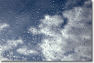
Drizzle is precipitation in the form of water droplets which are
smaller than raindrops.
Drizzle is characterized by fine, gently falling droplets and typically does not
impact human habitation in a negative way. The exception to this is freezing drizzle,
a condition where drizzle freezes immediately upon reaching earth's surface.
Freezing drizzle is still less dangerous than freezing rain, but can
potentially result in hazardous road conditions.
Next Topic: Evaporation
Weather Topic: What is Fog?
Home - Education - Cloud Types - Fog
 Next Topic: Fractus Clouds
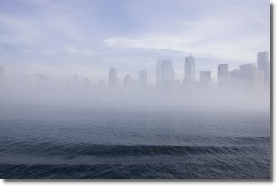
Fog is technically a type of stratus cloud, which lies along the
ground and obscures visibility.
It is usually created when humidity in the air condenses into tiny water droplets.
Because of this, some places are more prone to foggy weather, such as regions
close to a body of water.
Fog is similar to mist; both are the appearance of water droplets suspended in
the air, but fog is the term applied to the condition when visibility is less than 1 km.
Next Topic: Fractus Clouds
Current conditions powered by WeatherAPI.com


