Weather Alert in Illinois
Flood Warning issued April 2 at 12:13PM EDT by NWS Indianapolis IN
AREAS AFFECTED: Crawford, IL; Lawrence, IL; Knox, IN; Sullivan, IN
DESCRIPTION: ...The National Weather Service in Indianapolis IN has issued a Flood Warning for the following rivers in Indiana...Illinois... Wabash River at Terre Haute. Wabash River at Hutsonville Legacy Power Plant Site. .Multiple rounds of rainfall will bring minor lowland flooding to the Wabash River basin that could hang around through much of next week. The current river forecasts include around an inch of rainfall through Saturday morning, but do not include rainfall from Saturday through Sunday. Higher rainfall amounts in the Wabash basin could increase crests or lengthen the amount of time in flood. * WHAT...Minor flooding is forecast. * WHERE...Wabash River at Hutsonville Legacy Power Plant Site. * WHEN...From Friday evening until further notice. * IMPACTS...At 20.0 feet, Leaverton Park in Palestine and park in Hutsonville begin to flood. Agricultural flooding spreads to higher land. Seep water is noticeable behind levees. Some elevated river cottages are surrounded by water. Several county or township roads east of Lincoln Heritage Trail between Palestine and Hutsonville in Crawford County Illinois are impassable. * ADDITIONAL DETAILS... - There is no current observed data. - Forecast...The river is expected to rise above flood stage tomorrow evening and continue rising to a crest of 20.9 feet Friday, April 10. - Flood stage is 16.0 feet. - http://www.weather.gov/safety/flood
INSTRUCTION: Turn around, don't drown when encountering flooded roads. Most flood deaths occur in vehicles. Motorists should not attempt to drive around barricades or drive cars through flooded areas. Additional information is available at www.weather.gov/ind. The next statement should be issued late tonight by around 200 AM EDT /100 AM CDT/.
Want more detail? Get the Complete 7 Day and Night Detailed Forecast!
Current U.S. National Radar--Current
The Current National Weather Radar is shown below with a UTC Time (subtract 5 hours from UTC to get Eastern Time).

National Weather Forecast--Current
The Current National Weather Forecast and National Weather Map are shown below.

National Weather Forecast for Tomorrow
Tomorrow National Weather Forecast and Tomorrow National Weather Map are show below.

North America Water Vapor (Moisture)
This map shows recent moisture content over North America. Bright and colored areas show high moisture (ie, clouds); brown indicates very little moisture present; black indicates no moisture.

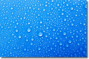
Weather Topic: What is Condensation?
Home - Education - Precipitation - Condensation
 Next Topic: Contrails
Condensation is the process which creates clouds, and therefore
it is a crucial process in the water cycle.
Condensation is the change of matter from a state of gas into a state of liquid,
and it happens because water molecules release heat into the atmosphere and
become organized into a more closely packed structure, what we might see as
water droplets.
Water is always present in the air around us as a vapor, but it's too small for
us to see. When water undergoes the process of condensation it becomes organized
into visible water droplets. You've probably seen condensation happen before on the
surface of a cold drink!
Next Topic: Contrails
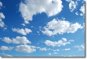
Weather Topic: What are Cumulonimbus Clouds?
Home - Education - Cloud Types - Cumulonimbus Clouds
 Next Topic: Cumulus Clouds
The final form taken by a growing cumulus cloud is the
cumulonimbus cloud, which is very tall and dense.
The tower of a cumulonimbus cloud can soar 23 km into the atmosphere, although
most commonly they stop growing at an altitude of 6 km.
Even small cumulonimbus clouds appear very large in comparison to other cloud types.
They can signal the approach of stormy weather, such as thunderstorms or blizzards.
Next Topic: Cumulus Clouds
Current conditions powered by WeatherAPI.com


