Weather Alert in Montana
High Wind Warning issued February 24 at 1:15PM MST until February 25 at 11:00PM MST by NWS Great Falls MT
AREAS AFFECTED: Cascade County below 5000ft; Judith Basin County and Judith Gap; Upper Blackfoot and MacDonald Pass; Gates of the Mountains; Little Belt and Highwood Mountains; Helena Valley; Big Belt, Bridger and Castle Mountains
DESCRIPTION: * WHAT...For the High Wind Warning, west winds 30 to 40 mph with gusts up to 70 mph expected. For the High Wind Watch, southwest winds 30 to 40 mph with gusts up to 70 mph possible. * WHERE...Cascade County, including the Little Belt and Highwood Mountains, Judith Basin County and Judith Gap, Upper Blackfoot and MacDonald Pass, Gates of the Mountains, Helena Valley, and Big Belt, Bridger and Castle Mountains. * WHEN...For the High Wind Warning, from 2 AM to 11 PM MST Wednesday. For the High Wind Watch, from Wednesday evening through Friday morning. * IMPACTS...High winds may move loose debris, damage property and cause power outages. Travel could be difficult, especially for high profile vehicles.
INSTRUCTION: People are urged to secure loose objects that could be blown around or damaged by the wind. Monitor the latest forecasts and warnings for updates.
Want more detail? Get the Complete 7 Day and Night Detailed Forecast!
Current U.S. National Radar--Current
The Current National Weather Radar is shown below with a UTC Time (subtract 5 hours from UTC to get Eastern Time).

National Weather Forecast--Current
The Current National Weather Forecast and National Weather Map are shown below.

National Weather Forecast for Tomorrow
Tomorrow National Weather Forecast and Tomorrow National Weather Map are show below.

North America Water Vapor (Moisture)
This map shows recent moisture content over North America. Bright and colored areas show high moisture (ie, clouds); brown indicates very little moisture present; black indicates no moisture.

Weather Topic: What are Cirrostratus Clouds?
Home - Education - Cloud Types - Cirrostratus Clouds
 Next Topic: Cirrus Clouds
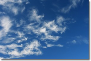
Cirrostratus clouds are high, thin clouds that form above
20,000 feet and are made mostly of ice crystals. They sometimes look like giant
feathers, horse tails, or curls of hair in the sky.
These clouds are pushed by the jet stream and can move at high speeds reaching
100 mph.
What do they indicate?
They indicate that a precipitation is likely within 24 hours.
Next Topic: Cirrus Clouds
Weather Topic: What is Condensation?
Home - Education - Precipitation - Condensation
 Next Topic: Contrails
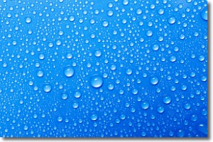
Condensation is the process which creates clouds, and therefore
it is a crucial process in the water cycle.
Condensation is the change of matter from a state of gas into a state of liquid,
and it happens because water molecules release heat into the atmosphere and
become organized into a more closely packed structure, what we might see as
water droplets.
Water is always present in the air around us as a vapor, but it's too small for
us to see. When water undergoes the process of condensation it becomes organized
into visible water droplets. You've probably seen condensation happen before on the
surface of a cold drink!
Next Topic: Contrails
Current conditions powered by WeatherAPI.com


