Weather Alert in Michigan
Hydrologic Outlook issued April 3 at 11:15AM EDT by NWS Grand Rapids MI
AREAS AFFECTED: Allegan, MI; Barry, MI; Calhoun, MI; Clare, MI; Clinton, MI; Eaton, MI; Gratiot, MI; Ingham, MI; Ionia, MI; Isabella, MI; Jackson, MI; Kalamazoo, MI; Kent, MI; Lake, MI; Mason, MI; Mecosta, MI; Montcalm, MI; Muskegon, MI; Newaygo, MI; Oceana, MI; Osceola, MI; Ottawa, MI; Van Buren, MI
DESCRIPTION: ESFGRR 2 To 4 inches of rain has fallen across a large portion of Lower Michigan over the last week. Rivers are now rising, and soils are saturated. A final round of rain from this storm cycle is expected to impact our area late Friday night and continue through the day Saturday. Most areas will receive an additional 0.5 to 1.0 inches of rain, with some indications that a few counties could end up with a streak of more like 1.5 to 2.5 inches of rain or more. If this heavier rain tracks over an urban area like Kalamazoo, Grand Rapids, or Lansing, localized urban flooding issues are likely. Meanwhile, as all this water continues to find its way into our river systems, minor flooding is becoming likely on parts of the Muskegon River, and is also a possibility on some of the typical flood-prone trouble spots in the Grand River watershed, including in Comstock Park and Maple River. Much will depend on exactly where the heaviest swath of the upcoming rain falls, but the bottom line is that some minor river flooding is becoming more likely across parts of Southwest and West-Central Michigan as all this rain continues to add up.
INSTRUCTION: N/A
Want more detail? Get the Complete 7 Day and Night Detailed Forecast!
Current U.S. National Radar--Current
The Current National Weather Radar is shown below with a UTC Time (subtract 5 hours from UTC to get Eastern Time).

National Weather Forecast--Current
The Current National Weather Forecast and National Weather Map are shown below.

National Weather Forecast for Tomorrow
Tomorrow National Weather Forecast and Tomorrow National Weather Map are show below.

North America Water Vapor (Moisture)
This map shows recent moisture content over North America. Bright and colored areas show high moisture (ie, clouds); brown indicates very little moisture present; black indicates no moisture.

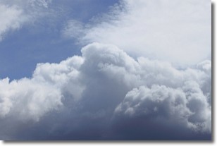
Weather Topic: What are Nimbostratus Clouds?
Home - Education - Cloud Types - Nimbostratus Clouds
 Next Topic: Precipitation
A nimbostratus cloud is similar to a stratus cloud in its formless,
smooth appearance. However, a nimbostratus cloud is darker than a stratus cloud,
because it is thicker.
Unlike a stratus cloud, a nimbostratus cloud typically brings with it the threat
of moderate to heavy precipitation. In some cases, the precipitation may evaporate
before reaching the ground, a phenomenon known as virga.
Next Topic: Precipitation
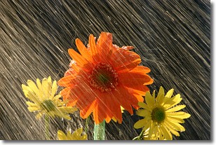
Weather Topic: What is Rain?
Home - Education - Precipitation - Rain
 Next Topic: Shelf Clouds
Precipitation in the form of water droplets is called rain.
Rain generally has a tendency to fall with less intensity over a greater period
of time, and when rainfall is more severe it is usually less sustained.
Rain is the most common form of precipitation and happens with greater frequency
depending on the season and regional influences. Cities have been shown to have
an observable effect on rainfall, due to an effect called the urban heat island.
Compared to upwind, monthly rainfall between twenty and forty miles downwind of
cities is 30% greater.
Next Topic: Shelf Clouds
Current conditions powered by WeatherAPI.com


