Weather Alert in Illinois
Severe Thunderstorm Warning issued April 2 at 6:04PM CDT until April 2 at 7:00PM CDT by NWS Quad Cities IA IL
AREAS AFFECTED: Carroll, IL; Jo Daviess, IL; Stephenson, IL; Whiteside, IL
DESCRIPTION: SVRDVN The National Weather Service in the Quad Cities has issued a * Severe Thunderstorm Warning for... North central Whiteside County in northwestern Illinois... Jo Daviess County in northwestern Illinois... Carroll County in northwestern Illinois... Stephenson County in northwestern Illinois... * Until 700 PM CDT. * At 604 PM CDT, severe thunderstorms were located along a line extending from Shullsburg to Stockton to near Wacker, moving northeast at 55 mph. HAZARD...60 mph wind gusts and quarter size hail. SOURCE...Radar indicated. IMPACT...Hail damage to vehicles is expected. Expect wind damage to roofs, siding, and trees. * Locations impacted include... Freeport, Mount Carroll, Lena, Stockton, Lanark, Warren, Milledgeville, Fairhaven, Pearl City, Elizabeth, Shannon, Cedarville, Davis, Woodbine, Chadwick, Dakota, German Valley, Scales Mound, Apple River, and Winslow.
INSTRUCTION: Remain alert for a possible tornado! Tornadoes can develop quickly from severe thunderstorms. If you spot a tornado go at once into the basement or small central room in a sturdy structure. For your protection move to an interior room on the lowest floor of a sturdy building. Continuous cloud to ground lightning is occurring with these storms. Move indoors immediately. Lightning is one of nature's leading killers. Remember, if you can hear thunder, you are close enough to be struck by lightning. A Tornado Watch remains in effect until 800 PM CDT for northwestern Illinois.
Want more detail? Get the Complete 7 Day and Night Detailed Forecast!
Current U.S. National Radar--Current
The Current National Weather Radar is shown below with a UTC Time (subtract 5 hours from UTC to get Eastern Time).

National Weather Forecast--Current
The Current National Weather Forecast and National Weather Map are shown below.

National Weather Forecast for Tomorrow
Tomorrow National Weather Forecast and Tomorrow National Weather Map are show below.

North America Water Vapor (Moisture)
This map shows recent moisture content over North America. Bright and colored areas show high moisture (ie, clouds); brown indicates very little moisture present; black indicates no moisture.

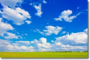
Weather Topic: What are Cumulus Clouds?
Home - Education - Cloud Types - Cumulus Clouds
 Next Topic: Drizzle
Cumulus clouds are fluffy and textured with rounded tops, and
may have flat bottoms. The border of a cumulus cloud
is clearly defined, and can have the appearance of cotton or cauliflower.
Cumulus clouds form at low altitudes (rarely above 2 km) but can grow very tall,
becoming cumulus congestus and possibly the even taller cumulonimbus clouds.
When cumulus clouds become taller, they have a greater chance of producing precipitation.
Next Topic: Drizzle
Weather Topic: What is Evaporation?
Home - Education - Precipitation - Evaporation
 Next Topic: Fog
Evaporation is the process which returns water from the earth
back to the atmosphere, and is another crucial process in the water cycle.
Evaporation is the transformation of liquid into gas, and it happens because
molecules are excited by the application of energy and turn into vapor.
In order for water to evaporate it has to be on the surface of a body of water.
Next Topic: Fog
Current conditions powered by WeatherAPI.com


