Weather Alert in Kansas
Red Flag Warning issued February 27 at 4:15AM CST until February 27 at 6:00PM CST by NWS Kansas City/Pleasant Hill MO
AREAS AFFECTED: Atchison; Miami; Linn; Doniphan; Leavenworth; Wyandotte; Johnson; Atchison; Nodaway; Worth; Gentry; Harrison; Mercer; Putnam; Schuyler; Holt; Andrew; De Kalb; Daviess; Grundy; Sullivan; Adair; Buchanan; Clinton; Caldwell; Livingston; Linn; Macon; Platte; Clay; Ray; Carroll; Chariton; Randolph; Jackson; Lafayette; Saline; Howard; Cass; Johnson; Pettis; Cooper; Bates; Henry
DESCRIPTION: * AFFECTED AREA...In Kansas, Fire Weather Zones 025, 057, 060, 102, 103, 104 and 105. In Missouri, Fire Weather Zones 001, 002, 003, 004, 005, 006, 007, 008, 011, 012, 013, 014, 015, 016, 017, 020, 021, 022, 023, 024, 025, 028, 029, 030, 031, 032, 033, 037, 038, 039, 040, 043, 044, 045, 046, 053 and 054. * TIMING...From noon today to 6 PM CST this evening. * IMPACTS...Any fire that develops will catch and spread quickly. Outdoor burning is not recommended. * WIND...Southwest to west at 15-20 mph, with gusts of 25-30 mph. * HUMIDITY...Below 25 percent.
INSTRUCTION: A Red Flag Warning means that critical fire weather conditions are either occurring now, or will shortly. A combination of strong winds, low relative humidity, and warm temperatures can contribute to extreme fire behavior.
Want more detail? Get the Complete 7 Day and Night Detailed Forecast!
Current U.S. National Radar--Current
The Current National Weather Radar is shown below with a UTC Time (subtract 5 hours from UTC to get Eastern Time).

National Weather Forecast--Current
The Current National Weather Forecast and National Weather Map are shown below.

National Weather Forecast for Tomorrow
Tomorrow National Weather Forecast and Tomorrow National Weather Map are show below.

North America Water Vapor (Moisture)
This map shows recent moisture content over North America. Bright and colored areas show high moisture (ie, clouds); brown indicates very little moisture present; black indicates no moisture.

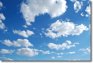
Weather Topic: What are Cumulonimbus Clouds?
Home - Education - Cloud Types - Cumulonimbus Clouds
 Next Topic: Cumulus Clouds
The final form taken by a growing cumulus cloud is the
cumulonimbus cloud, which is very tall and dense.
The tower of a cumulonimbus cloud can soar 23 km into the atmosphere, although
most commonly they stop growing at an altitude of 6 km.
Even small cumulonimbus clouds appear very large in comparison to other cloud types.
They can signal the approach of stormy weather, such as thunderstorms or blizzards.
Next Topic: Cumulus Clouds
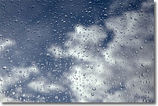
Weather Topic: What is Drizzle?
Home - Education - Precipitation - Drizzle
 Next Topic: Evaporation
Drizzle is precipitation in the form of water droplets which are
smaller than raindrops.
Drizzle is characterized by fine, gently falling droplets and typically does not
impact human habitation in a negative way. The exception to this is freezing drizzle,
a condition where drizzle freezes immediately upon reaching earth's surface.
Freezing drizzle is still less dangerous than freezing rain, but can
potentially result in hazardous road conditions.
Next Topic: Evaporation
Current conditions powered by WeatherAPI.com


