Weather Alert in Hawaii
High Surf Advisory issued February 25 at 3:05AM HST until February 25 at 6:00PM HST by NWS Honolulu HI
AREAS AFFECTED: Niihau; Oahu North Shore; Olomana; Maui Windward West; Kauai North; Kauai East; Koolau Windward; Molokai Windward; Molokai North; Maui Central Valley North; Windward Haleakala; Big Island East; Big Island North
DESCRIPTION: ...HIGH SURF ADVISORY FOR NORTH AND EAST FACING SHORES OF NIIHAU KAUAI OAHU MOLOKAI MAUI AND BIG ISLAND... .A declining north-northeast (010-030 degrees) will continue to produce advisory level surf along north and exposed east facing coastlines of most islands today. * WHAT...Along north facing shores, surf of 15 to 20 feet through morning, dropping to 12 to 16 feet in the afternoon. Along east facing shores, surf of 10 to 14 feet through morning, dropping to 8 to 12 feet in the afternoon. * WHERE...North and east facing shores of Niihau, Kauai, Oahu, Molokai, Maui, and Big Island. * WHEN...Until 6 PM HST this evening. * IMPACTS...Moderate. Strong breaking waves and strong currents will make swimming dangerous.
INSTRUCTION: Heed all advice from ocean safety officials. When in doubt, don't go out.
Want more detail? Get the Complete 7 Day and Night Detailed Forecast!
Current U.S. National Radar--Current
The Current National Weather Radar is shown below with a UTC Time (subtract 5 hours from UTC to get Eastern Time).

National Weather Forecast--Current
The Current National Weather Forecast and National Weather Map are shown below.

National Weather Forecast for Tomorrow
Tomorrow National Weather Forecast and Tomorrow National Weather Map are show below.

North America Water Vapor (Moisture)
This map shows recent moisture content over North America. Bright and colored areas show high moisture (ie, clouds); brown indicates very little moisture present; black indicates no moisture.

Weather Topic: What are Wall Clouds?
Home - Education - Cloud Types - Wall Clouds
 Next Topic: Altocumulus Clouds
A wall cloud forms underneath the base of a cumulonimbus cloud,
and can be a hotbed for deadly tornadoes.
Wall clouds are formed by air flowing into the cumulonimbus clouds, which can
result in the wall cloud descending from the base of the cumulonimbus cloud, or
rising fractus clouds which join to the base of the storm cloud as the wall cloud
takes shape.
Wall clouds can be very large, and in the Northern Hemisphere they generally
form at the southern edge of cumulonimbus clouds.
Next Topic: Altocumulus Clouds
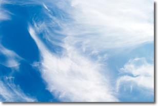
Weather Topic: What are Altostratus Clouds?
Home - Education - Cloud Types - Altostratus Clouds
 Next Topic: Cirrocumulus Clouds
Altostratus clouds form at mid to high-level altitudes
(between 2 and 7 km) and are created by a warm, stable air mass which causes
water vapor
to condense as it rise through the atmosphere. Usually altostratus clouds are
featureless sheets characterized by a uniform color.
In some cases, wind punching through the cloud formation may give it a waved
appearance, called altostratus undulatus. Altostratus clouds
are commonly seen with other cloud formations accompanying them.
Next Topic: Cirrocumulus Clouds
Current conditions powered by WeatherAPI.com


