Weather Alert in North Carolina
Extreme Heat Warning issued June 25 at 1:54AM EDT until June 25 at 8:00PM EDT by NWS Newport/Morehead City NC
AREAS AFFECTED: Martin; Pitt; Washington; Tyrrell; Mainland Dare; Greene; Beaufort; Mainland Hyde; Duplin; Lenoir; Jones; Pamlico; Northern Craven; Southern Craven; West Carteret; East Carteret; Inland Onslow; Coastal Onslow; Northern Outer Banks; Ocracoke Island; Hatteras Island
DESCRIPTION: * WHAT...Dangerously hot conditions with heat index values 110 to 115 expected. * WHERE...Portions of eastern North Carolina. * WHEN...Until 8 PM EDT this evening. * IMPACTS...Heat related illnesses increase significantly during extreme heat and high humidity events. * ADDITIONAL DETAILS...A dangerous, and longer-lasting, heatwave will continue to impact all of ENC through the middle of this week. The cumulative impact of the heat, along with little relief at night, will magnify the level of impact.
INSTRUCTION: Do not leave young children and pets in unattended vehicles. Car interiors will reach lethal temperatures in a matter of minutes. To reduce risk during outdoor work, the Occupational Safety and Health Administration recommends scheduling frequent rest breaks in shaded or air conditioned environments. Anyone overcome by heat should be moved to a cool and shaded location. Heat stroke is an emergency! Call 9 1 1.
Want more detail? Get the Complete 7 Day and Night Detailed Forecast!
Current U.S. National Radar--Current
The Current National Weather Radar is shown below with a UTC Time (subtract 5 hours from UTC to get Eastern Time).

National Weather Forecast--Current
The Current National Weather Forecast and National Weather Map are shown below.

National Weather Forecast for Tomorrow
Tomorrow National Weather Forecast and Tomorrow National Weather Map are show below.

North America Water Vapor (Moisture)
This map shows recent moisture content over North America. Bright and colored areas show high moisture (ie, clouds); brown indicates very little moisture present; black indicates no moisture.

Weather Topic: What are Cumulonimbus Clouds?
Home - Education - Cloud Types - Cumulonimbus Clouds
 Next Topic: Cumulus Clouds
The final form taken by a growing cumulus cloud is the
cumulonimbus cloud, which is very tall and dense.
The tower of a cumulonimbus cloud can soar 23 km into the atmosphere, although
most commonly they stop growing at an altitude of 6 km.
Even small cumulonimbus clouds appear very large in comparison to other cloud types.
They can signal the approach of stormy weather, such as thunderstorms or blizzards.
Next Topic: Cumulus Clouds
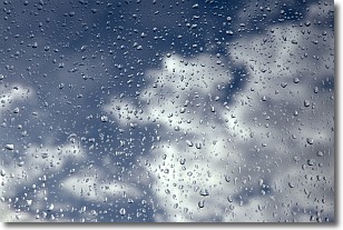
Weather Topic: What is Drizzle?
Home - Education - Precipitation - Drizzle
 Next Topic: Evaporation
Drizzle is precipitation in the form of water droplets which are
smaller than raindrops.
Drizzle is characterized by fine, gently falling droplets and typically does not
impact human habitation in a negative way. The exception to this is freezing drizzle,
a condition where drizzle freezes immediately upon reaching earth's surface.
Freezing drizzle is still less dangerous than freezing rain, but can
potentially result in hazardous road conditions.
Next Topic: Evaporation
Current conditions powered by WeatherAPI.com


