Weather Alert in Alaska
Flood Advisory issued September 1 at 9:48AM AKDT until September 4 at 9:15AM AKDT by NWS Anchorage AK
AREAS AFFECTED: Western Susitna Valley; Central Susitna Valley; Northern Susitna Valley
DESCRIPTION: * WHAT...Flooding caused by excessive rainfall is expected. * WHERE...Northern Susitna Valley in the Petersville area * WHEN...Until 915 AM AKDT Thursday. * IMPACTS...Minor flooding in low-lying and poor drainage areas. Rises in small streams. Some low-water crossings may become impassable. River or stream flows are elevated. * ADDITIONAL DETAILS... - 1 to 3 inches of rainfall is expected today (Monday) into tonight (Monday night). The heaviest rain is expected to occur across the headwaters of Peters Creek and Cache Creek. After a lull in rain on Tuesday, another round of rain set to occur on Wednesday is expected to bring another inch of rainfall. - Area creeks and streams are already running higher than normal after the rainfall from last week. While waters have been receding, additional rainfall may result in rises again this week. - Streams that may be affected include Peters Creek, Cache Creek, Moose Creek, Kroto Creek, and other nearby streams and their tributaries. Larger rivers such as that Yentna and Susitna are NOT expected to rise into flood stage again. - http://www.weather.gov/safety/flood
INSTRUCTION: Stay tuned to further developments by listening to your local radio, television, or NOAA Weather Radio for further information. Turn around, don't drown when encountering flooded roads. Most flood deaths occur in vehicles. Flooding is occurring or is imminent. It is important to know where you are relative to streams, rivers, or creeks which can become killers in heavy rains. Campers and hikers should avoid streams or creeks.
Want more detail? Get the Complete 7 Day and Night Detailed Forecast!
Current U.S. National Radar--Current
The Current National Weather Radar is shown below with a UTC Time (subtract 5 hours from UTC to get Eastern Time).

National Weather Forecast--Current
The Current National Weather Forecast and National Weather Map are shown below.

National Weather Forecast for Tomorrow
Tomorrow National Weather Forecast and Tomorrow National Weather Map are show below.

North America Water Vapor (Moisture)
This map shows recent moisture content over North America. Bright and colored areas show high moisture (ie, clouds); brown indicates very little moisture present; black indicates no moisture.

Weather Topic: What are Wall Clouds?
Home - Education - Cloud Types - Wall Clouds
 Next Topic: Altocumulus Clouds
A wall cloud forms underneath the base of a cumulonimbus cloud,
and can be a hotbed for deadly tornadoes.
Wall clouds are formed by air flowing into the cumulonimbus clouds, which can
result in the wall cloud descending from the base of the cumulonimbus cloud, or
rising fractus clouds which join to the base of the storm cloud as the wall cloud
takes shape.
Wall clouds can be very large, and in the Northern Hemisphere they generally
form at the southern edge of cumulonimbus clouds.
Next Topic: Altocumulus Clouds
Weather Topic: What are Altostratus Clouds?
Home - Education - Cloud Types - Altostratus Clouds
 Next Topic: Cirrocumulus Clouds
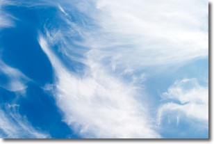
Altostratus clouds form at mid to high-level altitudes
(between 2 and 7 km) and are created by a warm, stable air mass which causes
water vapor
to condense as it rise through the atmosphere. Usually altostratus clouds are
featureless sheets characterized by a uniform color.
In some cases, wind punching through the cloud formation may give it a waved
appearance, called altostratus undulatus. Altostratus clouds
are commonly seen with other cloud formations accompanying them.
Next Topic: Cirrocumulus Clouds
Current conditions powered by WeatherAPI.com


