Weather Alert in Maine
Winter Weather Advisory issued April 2 at 2:41PM EDT until April 3 at 12:00PM EDT by NWS Gray ME
AREAS AFFECTED: Northern Oxford; Northern Franklin; Central Somerset
DESCRIPTION: A light wintry mix will overspread the area late this evening. The wintry mix will transition to light freezing rain late tonight into early Friday morning. * WHAT...Mixed precipitation expected. Total snow accumulations up to one inch, sleet accumulations around two tenths of an inch, and ice accumulations between one tenth and one quarter of an inch. Winds gusting as high as 25 to 35 mph. * WHERE...Central Somerset, Northern Franklin, and Northern Oxford Counties. * WHEN...From 11 PM this evening to noon EDT Friday. * IMPACTS...A period of mixed precipitation is expected with air temperatures remaining below freezing. Expect slippery road conditions and avoid travel if possible. The hazardous conditions could impact the Friday morning commute. Gusty winds will cause extra stress to trees and could break some tree limbs. The power outage threat is limited.
INSTRUCTION: Slow down and use caution while traveling. The latest road conditions can be obtained by going to newengland511.org
Want more detail? Get the Complete 7 Day and Night Detailed Forecast!
Current U.S. National Radar--Current
The Current National Weather Radar is shown below with a UTC Time (subtract 5 hours from UTC to get Eastern Time).

National Weather Forecast--Current
The Current National Weather Forecast and National Weather Map are shown below.

National Weather Forecast for Tomorrow
Tomorrow National Weather Forecast and Tomorrow National Weather Map are show below.

North America Water Vapor (Moisture)
This map shows recent moisture content over North America. Bright and colored areas show high moisture (ie, clouds); brown indicates very little moisture present; black indicates no moisture.

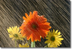
Weather Topic: What is Rain?
Home - Education - Precipitation - Rain
 Next Topic: Shelf Clouds
Precipitation in the form of water droplets is called rain.
Rain generally has a tendency to fall with less intensity over a greater period
of time, and when rainfall is more severe it is usually less sustained.
Rain is the most common form of precipitation and happens with greater frequency
depending on the season and regional influences. Cities have been shown to have
an observable effect on rainfall, due to an effect called the urban heat island.
Compared to upwind, monthly rainfall between twenty and forty miles downwind of
cities is 30% greater.
Next Topic: Shelf Clouds
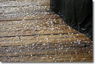
Weather Topic: What is Sleet?
Home - Education - Precipitation - Sleet
 Next Topic: Snow
Sleet is a form of precipitation in which small ice pellets are the primary
components. These ice pellets are smaller and more translucent than hailstones,
and harder than graupel. Sleet is caused by specific atmospheric conditions and
therefore typically doesn't last for extended periods of time.
The condition which leads to sleet formation requires a warmer body of air to be
wedged in between two sub-freezing bodies of air. When snow falls through a warmer
layer of air it melts, and as it falls through the next sub-freezing body of air
it freezes again, forming ice pellets known as sleet. In some cases, water
droplets don't have time to freeze before reaching the surface and the result is
freezing rain.
Next Topic: Snow
Current conditions powered by WeatherAPI.com


