Weather Alert in Illinois
Severe Thunderstorm Warning issued April 2 at 6:43PM CDT until April 2 at 7:30PM CDT by NWS Quad Cities IA IL
AREAS AFFECTED: Bureau, IL; Putnam, IL
DESCRIPTION: SVRDVN The National Weather Service in the Quad Cities has issued a * Severe Thunderstorm Warning for... Putnam County in north central Illinois... Southeastern Bureau County in north central Illinois... * Until 730 PM CDT. * At 643 PM CDT, severe thunderstorms were located along a line extending from Providence to Jubilee College State Park, moving northeast at 50 mph. HAZARD...60 mph wind gusts and quarter size hail. SOURCE...Radar indicated. IMPACT...Hail damage to vehicles is expected. Expect wind damage to roofs, siding, and trees. * Severe thunderstorms will be near... Milo, Lone Tree Corners, and Lake Thunderbird around 650 PM CDT. Bureau Junction and Putnam around 655 PM CDT. Hennepin and DePue around 700 PM CDT. Other locations in the path of these severe thunderstorms include Spring Valley, Mark, Florid, Granville, Dalzell, McNabb, Magnolia and Standard. This includes the following highways... Interstate 80 in Illinois between mile markers 71 and 72. Interstate 180 between mile markers 1 and 5.
INSTRUCTION: Remain alert for a possible tornado! Tornadoes can develop quickly from severe thunderstorms. If you spot a tornado go at once into the basement or small central room in a sturdy structure. For your protection move to an interior room on the lowest floor of a sturdy building. To report severe weather, contact your nearest law enforcement agency. They will send your report to the National Weather Service office in the Quad Cities. A Tornado Watch remains in effect until 800 PM CDT for north central Illinois.
Want more detail? Get the Complete 7 Day and Night Detailed Forecast!
Current U.S. National Radar--Current
The Current National Weather Radar is shown below with a UTC Time (subtract 5 hours from UTC to get Eastern Time).

National Weather Forecast--Current
The Current National Weather Forecast and National Weather Map are shown below.

National Weather Forecast for Tomorrow
Tomorrow National Weather Forecast and Tomorrow National Weather Map are show below.

North America Water Vapor (Moisture)
This map shows recent moisture content over North America. Bright and colored areas show high moisture (ie, clouds); brown indicates very little moisture present; black indicates no moisture.

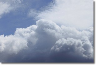
Weather Topic: What are Nimbostratus Clouds?
Home - Education - Cloud Types - Nimbostratus Clouds
 Next Topic: Precipitation
A nimbostratus cloud is similar to a stratus cloud in its formless,
smooth appearance. However, a nimbostratus cloud is darker than a stratus cloud,
because it is thicker.
Unlike a stratus cloud, a nimbostratus cloud typically brings with it the threat
of moderate to heavy precipitation. In some cases, the precipitation may evaporate
before reaching the ground, a phenomenon known as virga.
Next Topic: Precipitation
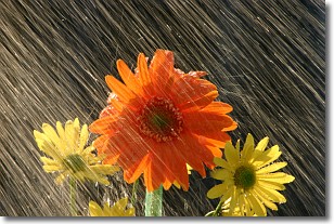
Weather Topic: What is Rain?
Home - Education - Precipitation - Rain
 Next Topic: Shelf Clouds
Precipitation in the form of water droplets is called rain.
Rain generally has a tendency to fall with less intensity over a greater period
of time, and when rainfall is more severe it is usually less sustained.
Rain is the most common form of precipitation and happens with greater frequency
depending on the season and regional influences. Cities have been shown to have
an observable effect on rainfall, due to an effect called the urban heat island.
Compared to upwind, monthly rainfall between twenty and forty miles downwind of
cities is 30% greater.
Next Topic: Shelf Clouds
Current conditions powered by WeatherAPI.com


