Weather Alert in Iowa
Flood Watch issued June 26 at 4:43AM CDT until June 27 at 11:30AM CDT by NWS Des Moines IA
AREAS AFFECTED: Polk; Warren
DESCRIPTION: ...The Flood Watch continues for the following rivers in Iowa... North River near Norwalk Hwy R57 affecting Polk and Warren Counties. * WHAT...Flooding is possible. * WHERE...The North River near Norwalk Hwy R57, or from the Madison-Warren County line to the Des Moines River. * WHEN...From this evening to late tomorrow morning. * IMPACTS...At 22.0 feet, Water is over Iowa 28 immediately south of Norwalk and threatens several rural gravel roads. * ADDITIONAL DETAILS... - At 4:31 AM CDT Thursday the stage was 15.5 feet. - Forecast...Flood stage may be reached this evening. - Flood stage is 22.0 feet.
INSTRUCTION: For the latest waterway observations and forecasts refer to weather.gov/desmoines/water. River forecasts include observed precipitation plus forecast precipitation over the next 24 hours.
Want more detail? Get the Complete 7 Day and Night Detailed Forecast!
Current U.S. National Radar--Current
The Current National Weather Radar is shown below with a UTC Time (subtract 5 hours from UTC to get Eastern Time).

National Weather Forecast--Current
The Current National Weather Forecast and National Weather Map are shown below.

National Weather Forecast for Tomorrow
Tomorrow National Weather Forecast and Tomorrow National Weather Map are show below.

North America Water Vapor (Moisture)
This map shows recent moisture content over North America. Bright and colored areas show high moisture (ie, clouds); brown indicates very little moisture present; black indicates no moisture.

Weather Topic: What is Snow?
Home - Education - Precipitation - Snow
 Next Topic: Stratocumulus Clouds
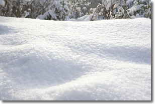
Snow is precipitation taking the form of ice crystals. Each ice crystal, or snowflake,
has unique characteristics, but all of them grow in a hexagonal structure.
Snowfall can last for sustained periods of time and result in significant buildup
of snow on the ground.
On the earth's surface, snow starts out light and powdery, but as it begins to melt
it tends to become more granular, producing small bits of ice which have the consistency of
sand. After several cycles of melting and freezing, snow can become very dense
and ice-like, commonly known as snow pack.
Next Topic: Stratocumulus Clouds
Weather Topic: What are Stratus Clouds?
Home - Education - Cloud Types - Stratus Clouds
 Next Topic: Wall Clouds
Stratus clouds are similar to altostratus clouds, but form at a
lower altitude and are identified by their fog-like appearance, lacking the
distinguishing features of most clouds.
Stratus clouds are wider than most clouds, and their base has a smooth, uniform
look which is lighter in color than a nimbostratus cloud.
The presence of a stratus cloud indicates the possibility of minor precipitation,
such as drizzle, but heavier precipitation does not typically arrive in the form
of a stratus cloud.
Next Topic: Wall Clouds
Current conditions powered by WeatherAPI.com


