Weather Alert in Idaho
Flash Flood Watch issued August 25 at 11:41AM MDT until August 28 at 12:00AM MDT by NWS Boise ID
AREAS AFFECTED: West Central Mountains; Lower Treasure Valley; Boise Mountains; Upper Treasure Valley; Southwest Highlands; Western Magic Valley; Camas Prairie; Owyhee Mountains; Southern Twin Falls County; Upper Weiser River; Harney County; Baker County; Malheur County; Oregon Lower Treasure Valley
DESCRIPTION: A surge of deep monsoonal moisture combined with a slow-moving upper trough will bring periods of heavy showers and thunderstorms across the region. This airmass contains anomalously high moisture content, supporting the potential for excessive rainfall. Flash flooding will be possible, especially in steep terrain, narrow canyons, and near recent burn scars where soils are less able to absorb rainfall. The greatest risk will be Tuesday afternoon through Wednesday evening as repeated rounds of storms move through. * WHAT...Flash flooding caused by excessive rainfall is possible. * WHERE...Portions of Idaho, including the following areas, Boise Mountains, Camas Prairie, Lower Treasure Valley, Owyhee Mountains, Southern Twin Falls County, Southwest Highlands, Upper Treasure Valley, Upper Weiser River, West Central Mountains and Western Magic Valley. Portions of Oregon, including the following areas, Baker County, Harney County, Malheur County and Oregon Lower Treasure Valley. * WHEN...From Tuesday afternoon through Wednesday evening. * IMPACTS...Heavy rainfall could trigger flash flooding or debris flows in and near recent wildfire burn scars. In addition urban street flooding is possible with the stronger storms. * ADDITIONAL DETAILS... - https://www.weather.gov/safety/flood
INSTRUCTION: You should monitor later forecasts and be prepared to take action should Flash Flood Warnings be issued. Local emergency services are monitoring the situation and will issue a public statement as conditions warrant. PLAN NOW so you will know what to do in an emergency. Keep informed by listening to local radio and television for statements and possible warnings. Follow the advice of public safety officials.
Want more detail? Get the Complete 7 Day and Night Detailed Forecast!
Current U.S. National Radar--Current
The Current National Weather Radar is shown below with a UTC Time (subtract 5 hours from UTC to get Eastern Time).

National Weather Forecast--Current
The Current National Weather Forecast and National Weather Map are shown below.

National Weather Forecast for Tomorrow
Tomorrow National Weather Forecast and Tomorrow National Weather Map are show below.

North America Water Vapor (Moisture)
This map shows recent moisture content over North America. Bright and colored areas show high moisture (ie, clouds); brown indicates very little moisture present; black indicates no moisture.

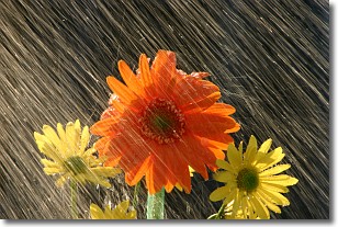
Weather Topic: What is Rain?
Home - Education - Precipitation - Rain
 Next Topic: Shelf Clouds
Precipitation in the form of water droplets is called rain.
Rain generally has a tendency to fall with less intensity over a greater period
of time, and when rainfall is more severe it is usually less sustained.
Rain is the most common form of precipitation and happens with greater frequency
depending on the season and regional influences. Cities have been shown to have
an observable effect on rainfall, due to an effect called the urban heat island.
Compared to upwind, monthly rainfall between twenty and forty miles downwind of
cities is 30% greater.
Next Topic: Shelf Clouds
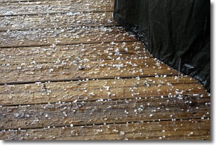
Weather Topic: What is Sleet?
Home - Education - Precipitation - Sleet
 Next Topic: Snow
Sleet is a form of precipitation in which small ice pellets are the primary
components. These ice pellets are smaller and more translucent than hailstones,
and harder than graupel. Sleet is caused by specific atmospheric conditions and
therefore typically doesn't last for extended periods of time.
The condition which leads to sleet formation requires a warmer body of air to be
wedged in between two sub-freezing bodies of air. When snow falls through a warmer
layer of air it melts, and as it falls through the next sub-freezing body of air
it freezes again, forming ice pellets known as sleet. In some cases, water
droplets don't have time to freeze before reaching the surface and the result is
freezing rain.
Next Topic: Snow
Current conditions powered by WeatherAPI.com


